Visual Evidence Systems for Long-Term Closure Reporting
Aerial Intelligence and version-controlled documentation for mine closure, post-closure monitoring, and long-term stakeholder reporting.
Closure is just the beginning of a long evidence cycle.
Mine closure is not simply the end of operations. It is the beginning of a long evidence cycle.
Mining companies must prove, over time, that stabilization, restoration, monitoring, and post-closure commitments are being executed and maintained. The work may be performed by engineering, environmental, legal, and closure teams — but the proof behind that work must survive years of reporting, staff changes, vendor changes, regulatory review, and stakeholder scrutiny.
Closure compliance can span 5, 10, or 20 years. During that time, site conditions evolve. Teams change. Vendors change. Reports are prepared every six months, annually, or according to project-specific monitoring requirements.
Yet the visual evidence behind those reports is often fragmented across drone folders, field photos, inspection notes, spreadsheets, emails, and external drives. That fragmentation creates risk.
The challenge is not only executing closure correctly. The challenge is proving it consistently over time.
33Visual helps mining companies build the proof behind closure progress.
We provide the structured visual, spatial, and temporal evidence layer that helps those teams document their work, organize proof, compare conditions over time, and communicate progress clearly.
33Visual does not replace the engineering, environmental, legal, or closure teams responsible for the Mine Closure Plan.
Through Aerial Intelligence, 3D documentation, 360º immersive review, and Corporate Storytelling, we transform site activity into an organized, version-controlled, and auditable Visual Evidence Library.
From field capture to organized visual proof.
Closure baseline
A high-resolution visual and geospatial baseline captured at the start of closure or post-closure monitoring. This may include aerial orthomosaics, oblique drone imagery, 3D models, 360º ground-level documentation, inspection photography, and executive visual summaries.
Single source of truth
Every capture is organized by site, date, asset type, monitoring area, and reporting cycle. The result is a single source of truth that helps teams retrieve, compare, and verify evidence across time.
Comparable over time
Documented drone capture logic creates visual continuity. The goal is to make Year 1, Year 5, Year 10, and Year 20 comparable — not just photographed.
Review without unnecessary exposure
Technical teams, executives, reviewers, insurers, and inspectors can review sensitive, restricted, or unstable areas remotely without requiring every stakeholder to physically enter the site.
Clear closure communication
We translate technical field captures into annotated visual packages that communicate progress, compliance support, environmental responsibility, and closure performance to regulators, boards, communities, and investors.
From evidence to understanding
Closure is also a reputational commitment. Corporate Storytelling helps operators communicate remediation, stabilization, and environmental responsibility with clarity and context.
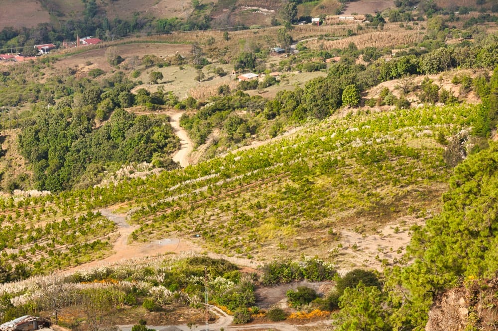
Closure assets, environmental controls, and physical evidence over time.
Designed to support reporting, monitoring, documentation, and stakeholder communication.
For technical teams
A reliable way to preserve field evidence, compare site conditions, and explain progress across multiple reporting cycles.
For executives and boards
A clearer way to review closure performance, understand risk, and see how current site conditions compare with the established baseline.
For reviewers and stakeholders
A structured visual record that can be understood without losing technical context.
33Visual does not provide legal compliance opinions. We provide the visual evidence architecture that helps mining companies and their technical advisors support reporting, monitoring, documentation, and stakeholder communication obligations.
Supporting the knowledge base behind closure and tailings governance.
ICMM Integrated Mine Closure
Integrated closure depends on a living knowledge base. 33Visual helps operators preserve baseline documentation, progressive rehabilitation evidence, inspection history, 3D models, and stakeholder-facing visual summaries that validate closure progress over time.
Global Industry Standard on Tailings Management
Tailings governance depends on current, reliable, and accessible knowledge. 33Visual helps maintain a high-resolution, version-controlled visual record of TSF conditions and translates technical evidence into clear communication packages for boards, independent reviewers, insurers, communities, and internal decision-makers.
Document closure progress with evidence that survives time.
Start with a Zero-Day Closure Catalog and establish the visual evidence system your team will rely on for long-term closure monitoring and stakeholder communication.
Request a Closure Evidence Review
Glossary & Terminology
Key terms used in closure evidence systems.
Key terms used in closure evidence systems.
Mine Closure
The planned transition from active mining to long-term physical, environmental, and social stability. Closure may include decommissioning, rehabilitation, monitoring, maintenance, reporting, and stakeholder engagement.
Post-Closure Monitoring
The monitoring period after major closure works are completed, during which operators continue to verify site stability, environmental performance, water management, vegetation recovery, and other closure commitments.
Tailings Storage Facility (TSF)
The current technical term for the full facility used to store and manage mine tailings. TSF is broader than “tailings dam” because it refers to the complete containment, deposition, water management, monitoring, and governance system.
Tailings Dam
A traditional term commonly used to describe the dam or embankment component of a tailings storage system. In current technical and governance language, TSF is generally the preferred broader term.
Heap Leach Pad
An engineered area where ore is stacked and processed through leaching. Closure evidence often focuses on containment, drainage, surface stabilization, revegetation, and long-term environmental performance.
Waste Rock Dump
A designated area where non-ore or low-grade excavated material is placed. Closure documentation may track slope stability, erosion control, runoff management, surface grading, and progressive reclamation.
Progressive Reclamation
Rehabilitation work completed during the life of the mine rather than waiting until final closure. Visual evidence helps show when and where reclamation work was completed and how conditions evolve over time.
Zero-Day Catalog
33Visual’s baseline visual and geospatial record captured at the start of closure or post-closure monitoring. It becomes the reference point for future comparison.
Visual Evidence Library
A structured, version-controlled archive of drone captures, ground imagery, 360º documentation, 3D models, inspection visuals, and executive summaries organized by date, site, asset, and reporting cycle.
Version-Controlled Archive
A documentation structure that preserves the history of each capture and reporting cycle, making it easier to compare site conditions and understand what changed over time.
Aerial Intelligence
33Visual’s service vertical for drone-based data acquisition, mapping, inspection, photogrammetry, 3D documentation, and repeatable visual monitoring of physical assets and site conditions.
Corporate Storytelling
33Visual’s service vertical for translating complex technical, operational, environmental, and social information into clear visual narratives for stakeholders, boards, communities, and investors.
Orthomosaic
A corrected aerial map created from many overlapping drone images. It provides a measurable, top-down visual record of site conditions at a specific point in time.
Photogrammetry
The process of using overlapping photographs to create measurable 2D maps, 3D models, terrain surfaces, and spatial records of a site or structure.
3D Model
A digital spatial representation of a site, landform, structure, or asset. In closure monitoring, 3D models help teams compare physical conditions and review areas remotely.
360º Remote Review
Immersive visual documentation that allows stakeholders to review site conditions remotely from a ground-level perspective, reducing unnecessary travel or exposure to restricted areas.
This glossary is intended to clarify terminology used in the 33Visual Mine Closure Visual Evidence System. It is not a legal, engineering, or environmental compliance opinion.